2000-2009

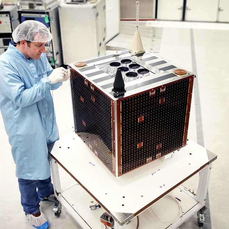
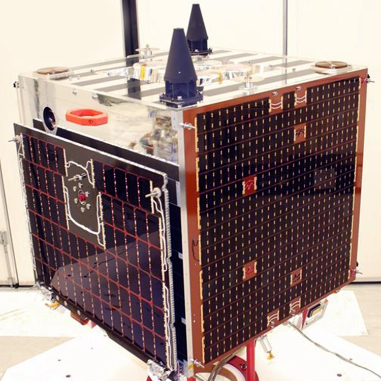
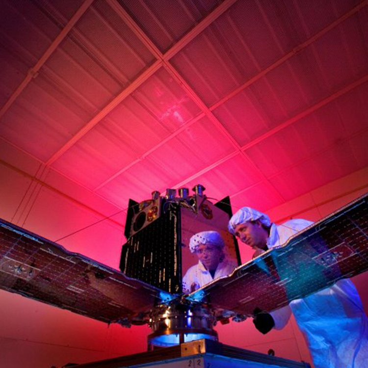
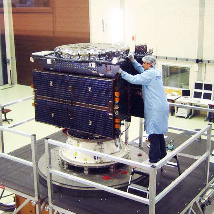
Deimos-1: Launched 2009

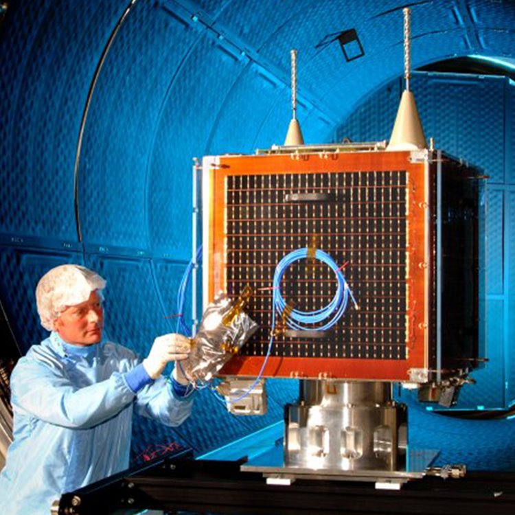
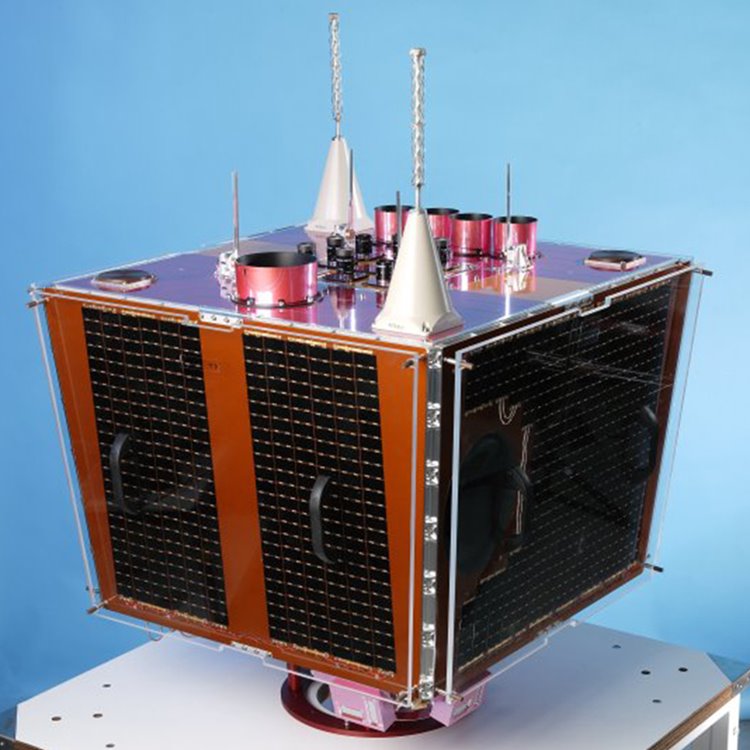
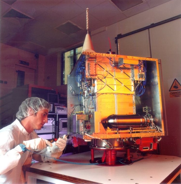
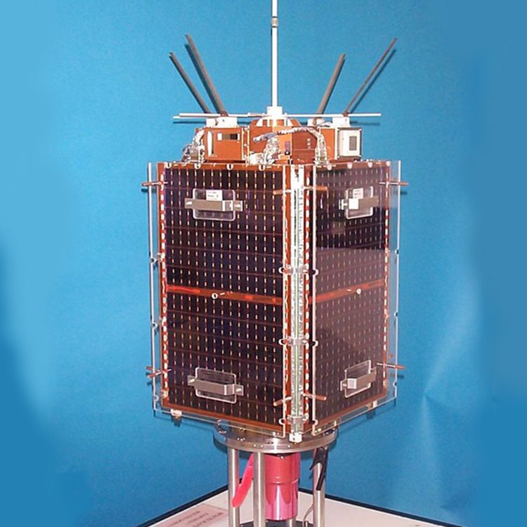
SSTL designed and manufactured Deimos-1 for the commercial imaging company, DEIMOS Imaging, an Urthecast company.  

Deimos-1 carries a multispectral optical instrument with a spatial resolution of 22 metres and a wide swath of more than 600 km. Due to its large swath, the satellite is capable of delivering double full coverage of Spain and Portugal every week, and a full coverage of Europe every 10 days.

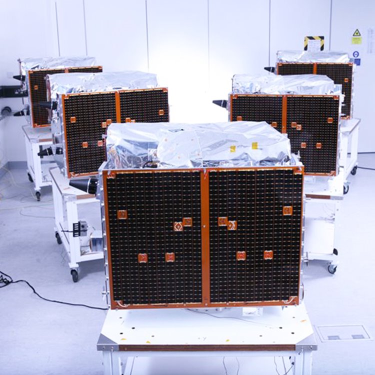
Deimos-1 also operates within the Disaster Monitoring Constellation, the first Earth observation constellation of low cost small satellites providing daily images for applications including global disaster monitoring. 

UK-DMC2: Launched 2009

UK-DMC2 was designed and manufactured by SSTL for the commercial imaging company, DMCii.  

The UK-DMC2 satellite carries a multispectral optical instrument with a spatial resolution of 22 m and a wide swath of more than 600 km.

RapidEyes 1-5: Launched 2008

SSTL manufactured five SSTL-150 platforms for the RapidEye constellation which launched in 2008. 

RapidEye is a commercial small satellite mission developed by MacDonald Dettwiler & Associates for RapidEye AG, a German geospatial organisation. The constellation was subsequently sold to BlackBridge and is now owned and managed by Planet.  

The high quality data from the constellation is used for agriculture, infrastructure and environmental & social studies.

CFESat: Launched 2007

SSTL supplied the platform for the Cibola Flight Experiment satellite (CFESat) to LANL.  

CFESat examines radio spectra for ionosphere and lightning studies, using field-programmable gate arrays (FPGAs).  As well as science observation, the mission aims to show use of reconfigurable FPGAs to work in the radiation environment of low Earth orbit.  

GIOVE-A: Launched 2005

GIOVE-A was developed by SSTL for the European Space Agency to secure the Galileo frequency filings at the International Telecommunications Union (ITU). 

The satellite also played a crucial role as the test-bed for the Galileo payload units, providing a representative signal-in-space for ground-based experimentation with Galileo signals as well as characterising the radiation environment for the Medium Earth Orbit used by all future Galileo satellites.

The satellite was designed, built and tested in a rapid 30 month programme and launched on schedule on 28th December 2005, allowing ESA to claim the frequency filings for the Galileo programme three months before the licence expired. 

On the 2nd May 2007 GIOVE-A successfully transmitted the first European navigation message from space, containing the information needed by users' receivers to calculate their position. 

In 2012 SSTL's experimental GPS receiver on-board GIOVE-A successfully achieved a GPS position fix at 23,300km altitude - the first position fix above the GPS constellation on a civilian satellite.

In 2021 GIOVE-A was de-commissioned in orbit by SSTL after 16 years of operational service.  

Beijing-1: Launched 2005

Beijing-1 is a low cost Earth Observation (EO) satellite, carrying two payloads that provide high-resolution (4-metre) panchromatic images alongside medium-resolution (32-metre) multi-spectral images with an ultra-wide 600km imaging swath.

Beijing-1 provides the Chinese government and commercial users with information on agriculture, water resources, environment and disaster monitoring throughout China. The satellite is also used extensively for monitoring urban development and pollution and to generate digital maps of China using the high-resolution panchromatic imager. 

TopSat: Launched 2005

TopSat was designed to use controlled spacecraft manoeuvres to increase the exposure time of images. This ensured high-resolution images could be obtained, even in poor light. The single instrument on board is an imager collecting 17 x 17 km images of the earth with a panchromatic (black and white) resolution of 2.5 metres and a multispectral (colour) resolution of 5 metres.  The camera was designed at STFC Rutherford Appleton Laboratory.

UK-DMC-1: Launched 2003

UK-DMC-1 was an earth observation satellite for the then BNSC (now the UK Space Agency). It carried a 32m imager operating in 3 spectral bands.

UK-DMC-1 operated within the Disaster Monitoring Constellation, the first Earth observation constellation of low cost small satellites providing daily images for applications including global disaster monitoring. 

NigeriaSat-1: Launched 2003

Built under a training and transfer programme with the Nigeria Space Research & Development Agency, the 100kg NigeriaSat-1 satellite provided 32m multispectral imaging with a 600km wide swath.  The imaging system was fitted with normalised differential vegetative index (NDVI) technology capable of giving early warning signals of natural and environmental disasters.

Hurricane Katrina
In August 2005, the seventh most intense Atlantic hurricane hit the Gulf coast of America where it caused severe destruction and flooding resulting in over 1,800 deaths.  The worst affected area was New Orleans, where the levee system failed and 80% of the city was flooded. NigeriaSat-1 provided the first satellite image of New Orleans to the USA’s disaster response co-ordinators. It captured a wide-area image that showed breaks in the levee system along the coastline, and the extensive inland flooding of the city. 
 
In 2012 NigeriaSat-1 was retired from service after 8 years.  

BILSAT-1: Launched 2003

BILSAT-1 was the first Turkish Scientific Earth Observation satellite and was built under a training and development programme between SSTL and TUBITAK-BILTEN. The satellite benefited from on-board propulsion, GPS navigation and included experimental payloads including a multi-band imaging system, a real time image compression module, a GPS attitude receiver and a Control Moment Gyro. BILSAT-1 also hosted new technologies such as high capacity solid-state data recorders and star trackers.

BILSAT-1 carried five Earth observation cameras, one panchromatic and the remaining four obtained images in the red, green, blue and near-infrared bands.

ALSAT-1: Launched 2002

ALSAT-1 was Algeria's first national satellite and was designed and constructed by SSTL within a collaborative programme with the Algerian Centre National des Techniques Spatiales (CNTS).

ALSAT-1 carried Earth imaging cameras which provided 32-meters resolution imaging in 3 spectral bands (NIR, red, green) with an extremely wide imaging swath of 600 km. ALSAT-1 was the first satellite in the Disaster Monitoring Constellation.

PICOSat: Launched 2001

PICOSat was designed and built to test electronic components/systems in space conditions for the US Air Force. It carried four test payloads: Polymer Battery Experiment (PBEX), Ionospheric Occultation Experiment (IOX), Coherent Electromagnetic Radio Tomography (CERTO) and an ultra-quiet platform (OPPEX).

PICOSat was designed for a minimum of one year of on orbit operations. PICOSat used a gravity gradient boom for stabilization. The Ultra-Quiet Platform (UQP), developed by the Air Force Research Lab, aimed to provide a 10:1 reduction in vibration isolation over a 100 Hz bandwidth between the spacecraft bus and a science payload.

Tsinghua-1: Launched 2000

Tsinghua-1 was a microsatellite developed and built in a joint venture between SSTL and Tsinghua University in Beijing, China. A team of 10 Chinese researchers from Tsinghua University worked alongside the SSTL team during the 18 month project. 

Tsinghua-1 was a 50kg demonstrator microsatellite with a mission  to demonstrate high-resolution imaging for disaster monitoring and mitigation and conduct communications research in LEO.

SNAP-1: Launched 2000

The SNAP-1 nanosatellite was designed to develop a modular, multi-mission nanosatellite bus (mass range of 10-10kg), to demonstrate the use of miniature electrical and mechanical COTS product technologies in space, and their use as autonomous robots for observing orbiting spacecraft.

SNAP-1 was designed and built as a low-cost research mission by a joint academic-commercial team at the Surrey Space Centre and at SSTL, funded entirely by SSTL.

TiungSat-1: Launched 2000

The TiungSat-1 satellite was Malaysia's first operational satellite and was launched in 2000.  The contract with SSTL included training a team of Malaysian space engineers.

TiungSat-1 mission objectives: 

·  Collection of imagery for environmental and meteorological use
·  Digital S&F (Store & Forward) communications
·  Technology demonstration
·  Space science
·  Amateur radio access