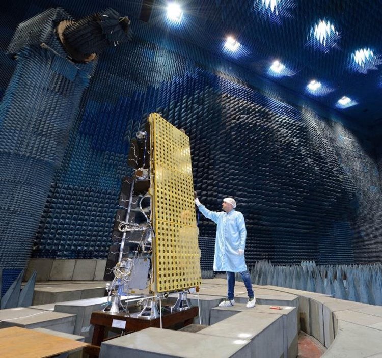
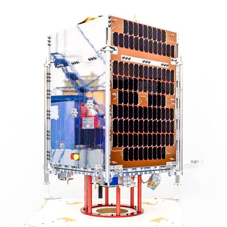
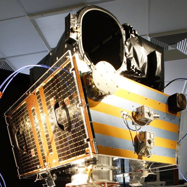
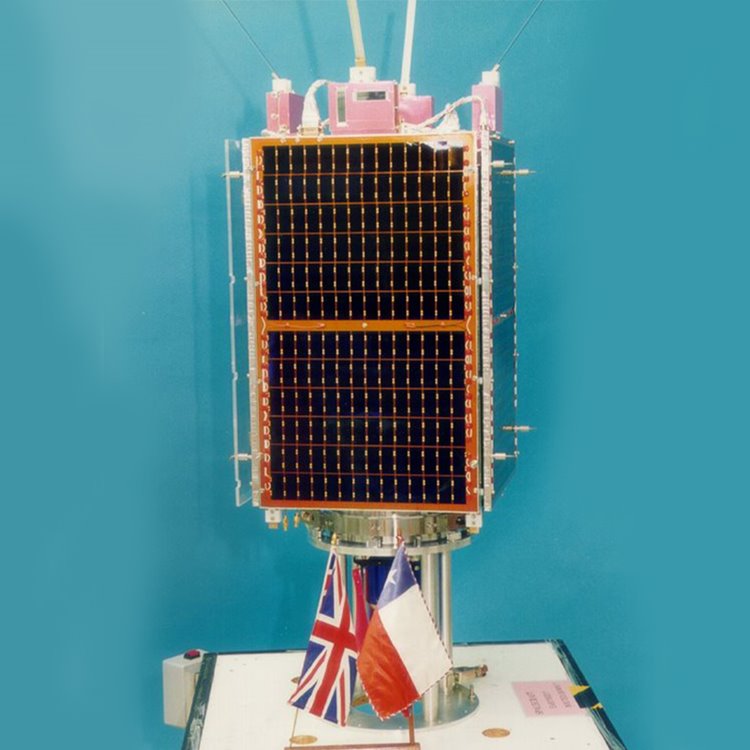
We supplied the small geostationary satellite platform for the first “EUTELSAT QUANTUM” class telecommunications spacecraft. We were under contract to prime contractor, Airbus Defence and Space, who supplied the flexible payload for the spacecraft.
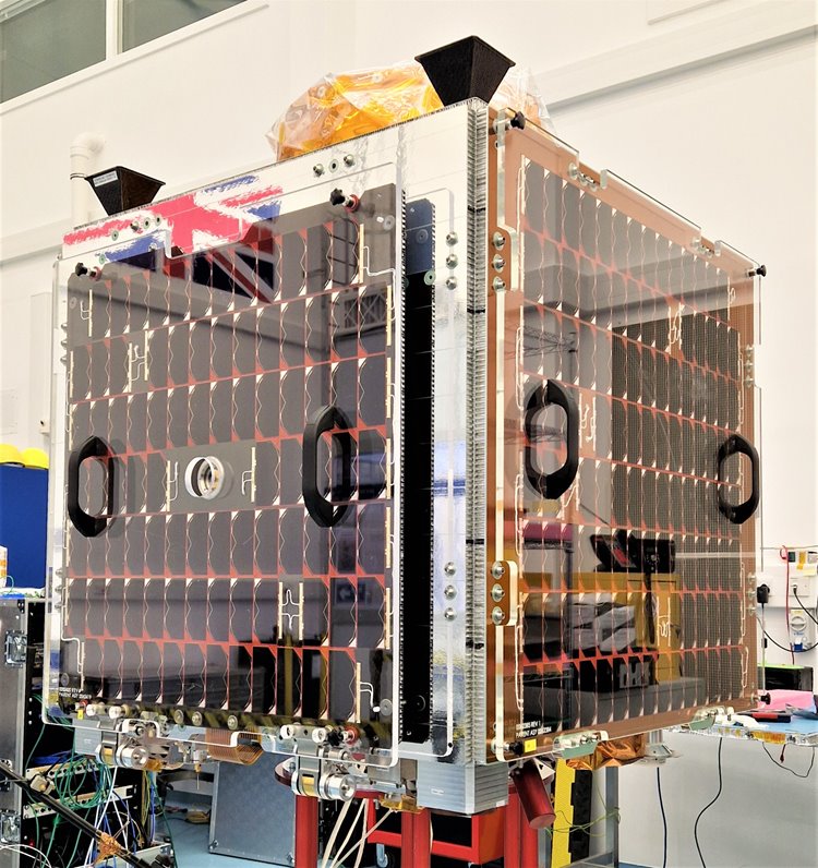
EUTELSAT QUANTUM is SSTL's first geostationary satellite platform and the new spacecraft design will represent a first in the commercial satellite industry, by enabling the complete electronic synthesis of “receive” and “transmit” coverages in the Ku-band.
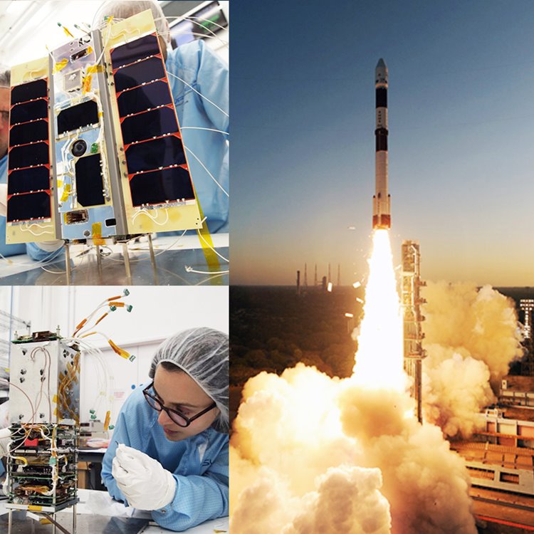
SSTL supplied the Client satellite and avionics for ASTROSCALE's inaugral ELSA-d mission, which will simulate capture of orbital debris and is designed to validate key technologies for end-of-life spacecraft retrieval and disposal services.
The ELSA-d mission comprises of a "Servicer" satellite and a Client (target) satellite, and will demonstrate key technologies necessary for orbital debris removal such as rendezvous and docking and proximity operations. ASTROSCALE are designing and manufacturing the Servicer satellite in Tokyo using avionics from SSTL.
Click here to watch ASTROSCALE's ELSA-d mission animation.
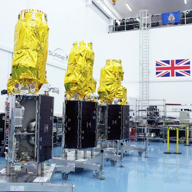
Between 2010 and 2020 SSTL manufactured and delivered 34 navigation payloads for the deployment phase of Galileo, Europe's satellite navigation system.
OHB System AG was the prime contractor and builder of the spacecraft platform and SSTL had full responsibility for the navigation payloads, the brains of Galileo's navigation system.
DoT-1 is a technology demonstration small satellite mission trialling new generation avionics for SSTL.
DoT-1 flies a commercial off the shelf Raspberry Pi camera which captured an image of the Mediterranean and a video of Europe
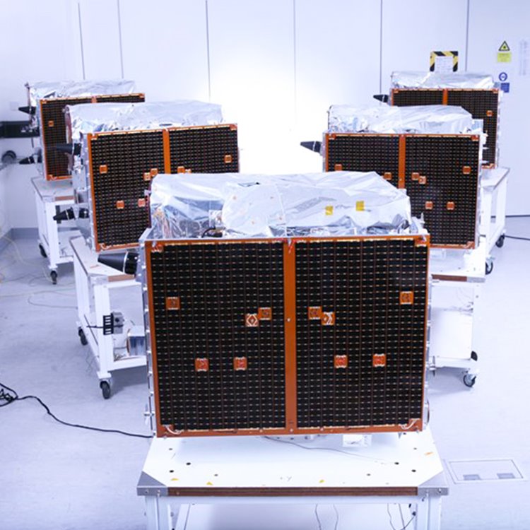
We supplied 6 spacecraft platforms for the FORMOSAT-7/COSMIC-2 Program, a joint meteorological satellite constellation between Taiwan and the United States for observing and monitoring the global meteorology, climate, and ionosphere. The goal of the joint program is to establish an operational constellation to replace the current FORMOSAT-3/COSMIC mission.
The ESPA class platorm for the Orbital Test Bed (OTB) satellite was designed and manufactured by SSTL before being shipped to the US for testing and payload integration at SSTL's US office in Denver, Colarado which was acquired by General Atomics Electromagnetic Systems Group in 2017. OTB carries five demonstration payloads including NASA's Deep Space Atomic Clock, for a variety of commercial, US government, and academic organisations.
SSTL has supplied suites of satellite avionics and software plus system design support, power management and batteries, on board computers and data handling capabilities for satellite subsystems and satellite operations to NPP VNIIEM for their KANOPUS-V satellite programmes.
SSTL has also supported spacecraft assembly, integration and in orbit commissioning activities for these satellites in Russia.
VESTA is a 3U nanosatellite technology demonstration mission testing a new two-way VHF Data Exchange System (VDES) payload developed by Honeywell for the exactEarth advanced maritime satellite constellation. The 4kg satellite has 3-axis pointing capability, an SEU tolerant on-board computer, VxWorks operating system and also flies a Commercial-Off-The-Shelf (COTS) VHF deployable antenna system developed by Innovative Solutions in Space for the VDES transceiver.
KazSTSAT is a small Earth observation satellite jointly developed by SSTL and JV Ghalam LLP. The satellite has a mass of 105kg and acquires image data at 18.7 m GSD with a swath width of 275 km. The spacecraft carries several experimental and demonstration units, including a beyond diffraction limit imager, a sun sensor, and a novel OBCARM. KazSTSAT is operated by Ghalam, using a fully virtualized ground segment with S/X-band software defined back-ends deployed at KSAT ground stations in Svalbard and a technology demonstration ground station in Astana.
NovaSAR-1 is a small Synthetic Aperture Radar (SAR) mission designed for low-cost programmes and optimised for shared launch opportunities. The system baselines heritage avionics with an imaging payload developed by the space borne SAR team at Airbus in Portsmouth, UK, and S-band solid state power amplifier technology.
NovaSAR-1 has been part-funded by the UK Government. Mission partners signed up for capacity from NovaSAR-1 include the UK Space Agency, Australia’s Commonwealth Scientific and Industrial Research Organisation (CSIRO), the Indian Space Research Organisation (ISRO), the Republic of the Philippines Department of Science and Technology-Advanced Science and Technology Institute (DOST-ASTI) and Space-Eyes.LLC.
The SSTL S1-4 satellite has a mass of 440kg and is capable of acquiring multiple targets in one pass, utilising spot, strip and mosaic imaging modes and 45 degree off-pointing agility for a range of applications including urban planning, agricultural monitoring, land classification, natural resource management and disaster monitoring. The very high resolution imager on board the spacecraft was designed and manufactured by SSTL and acquires sub 1 metre resolution images in panchromatic mode and sub 4 metre resolution images in multispectral mode, with a swath width of about 20.8km.
Data capacity from the satellite is leased to Airbus, Twenty First Century Aerospace Technology Co Ltd (21AT) and LatConnect60.
SSTL has supplied suites of satellite avionics and software plus system design support, power management and batteries, on board computers and data handling capabilities for satellite subsystems and satellite operations to NPP VNIIEM for their KANOPUS-V satellite programmes.
SSTL has also supported spacecraft assembly, integration and in orbit commissioning activities in Russia.
Remove Debris was deployed from the International Space Station on 20th June 2018, with launch service interface and launch provision by NanoRacks and NASA respectively.
The RemoveDEBRIS mission achieved the first ever in-orbit demonstration of space debris capture and performed four active space debris removal technology demonstrations, testing novel technologies, representative of an operational scenario during a low-cost mission.
SSTL designed and manufactured the Remove Debris satellite platform, which hosted the payloads for use in the debris removal demonstrations. These payloads, or technical content within them, were produced by mission partners Airbus, ArianeGroup, CSEM, Inria, ISIS, SSC, and Stellenbosch University.
After a successful mission RemoveDEBRIS burned up in Earth's atmosphere on 4th December 2021.
The Remove Debris mission received funding from the European Commission. Specifically, the research leading to these results has received funding from the European Union Seventh Framework Programme (FP7/2007-2013) under grant agreement #607099.
CARBONITE-2 is a 100kg earth observation technology demonstration mission owned and operated by SSTL. It demonstrates a low cost video-from-orbit solution designed to deliver 1m resolution images and colour HD video clips with a swath width of 5km.
View videos acquired by the satellite in orbit.
SSTL supplied a small low earth orbit (LEO) satellite to Telesat, a leading global satellite operator, as part of a test and validation phase for an advanced, global LEO satellite constellation.
The satellite flies an SSTL-built Ka payload and utilises hydrazine propulsion systems for in-orbit raising and de-orbiting. It is operated by Telesat in low earth orbit at ~1000km
In 2019 Telesat LEO Phase 1 satellite demonstrated the first ever 5G connectivity on a LEO spacecraft.
Kanopus V IR is an Earth Observation satellite manufactured by Russia’s NPP VNIIEM with spacecraft avionics, computers and power distribution from SSTL.
Kanopus-V IR is fitted with an additional infrared imaging payload and a Panchromatic Imaging System (PSS), a Multispectral Imaging System (MSS) and a prototype Multispectral Scanner Unit (MSU-200). The panchromatic imager, has a resolution of 2.5 metres.
Lomonosov is a mission for Russia to study transient phenomena in the Earth's upper atmosphere, cosmic rays and gamma ray bursts.
SSTL supplied satellite avionics and software plus system design support, power management and batteries, on board computers and data handling capabilities for satellite subsystems and satellite operations to NPP VNIIEM for this satellite programme.
Lomonosov is a mission for Russia to study transient phenomena in the Earth's upper atmosphere, cosmic rays and gamma ray bursts.
AlSat-1B is based on the SSTL-100 platform, hosting a 24m multispectral imager and a 12m panchromatic imager. Eighteen ASAL engineers undertook the Assembly, Integration and Test phase of the satellite in Algeria, offering further opportunities for the transfer of skills and the development of local capabilities.
The satellite is used for agricultural and disaster monitoring.
Under a £110m contract SSTL designed and manufactured three SSTL-300S1 satellite platforms, a new smallsat design which provides unparalleled 1 metre high resolution imagery with high speed downlink and 45 degree off-pointing.
The three satellites formed a new constellation, TripleSat, with daily revisit times which is crucial for change detection, disaster monitoring and response planning, and essential for acquiring cloud-free imagery. Beijing-based commercial imaging company, 21AT, has leased 100% of the imaging capacity of the three satellites.
CARBONITE-1 is a technology demonstration mission for SSTL, designed to demonstrate video-from-orbit capability using rapid-build techniques and to test COTS components and new avionics in orbit.
The satellite was designed, built and tested in 6 months and 12 days. In an orbit of 500km the imager is designed to provide 1m GSD with a swath width of 5km. The Commercial-off-the-Shelf industrial video camera, adapted by SSTL for space provides 15 second HD video clips at 1m GSD.
UK industry and academia worked together with Surrey Satellite Technology Ltd (SSTL) on a new innovative satellite to trial UK space technologies and provide an ‘in-orbit test facility’ for innovative UK payloads and software.
At around one meter cubed (roughly the size of a washing machine) and a surprisingly light mass of around 150kg, TechDemoSat (TDS-1) carried eight payloads plus a mixture of heritage and new product development systems from SSTL.
In May 2019, TechDemoSat-1 reached the end of its mission life and a drag sail supplied by Cranfield University was deployed to increase the rate of orbital decay.
Kazakhstan's KazEOSat-2 satellite delivers medium resolution images with 6.5m GSD and a 77km swath.
Under the contract SSTL also provided 6 months hands-on training for 19 customer engineers and Managers.
KazEOSAT-2 medium resolution imagery is utlised for mapping, agricultural monitoring and resource management.
Space researchers at the University of Surrey's Surrey Space Centre and SSTL engineers developed STRaND-1, a 3U CubeSat weighing 3.5kg containing a smartphone payload that was launched into orbit in 2013. STRaND-1 was built in engineer's free time using advanced commercial off-the-shelf components.
SSTL supplied the satellite platform to MacDonald Dettwiler Associates for the SAPPHIRE satellite-based Resident Space Object (RSO) observing service that provides accurate tracking data on deep space orbiting objects.
SAPPHIRE is a key element of the Canadian Space Surveillance System, and is a contributing sensor to the US Space Surveillance Network. It is a space-based electro-optical sensor that will provide accurate and timely tracking data to the Canadian Department of National Defence (DND) on space objects at orbit altitudes between 6,000km and 40,000km.
MDA is the prime contractor for the SAPPHIRE mission, including launch.
We supplied the platform for exactView-1 which forms part of the ExactEARTH AIS constellation used by ships and traffic to monitor ship movements through busy shipping channels and harbours and to provide information on global shipping movements.
exactView-1 was launched on 22nd July 2012 on a Soyuz rocket from Baikonur Cosmodrome.
SSTL has supplied suites of satellite avionics and software plus system design support, power management and batteries, on board computers and data handling capabilities for satellite subsystems and satellite operations to NPP VNIIEM for their KANOPUS-V1 satellite programme. SSTL has also supported spacecraft assembly and integration activities in Russia.
KANOPUS-V1 has been developed for Russia and will record abnormal phenomena to study the possibility of earthquake prediction as well as monitoring agriculture, water and coastal resources. The satellites carry a Russian-built 2.1m panchromatic imager plus a 10.5m multispectral imager.
The NigeriaSat-2 Earth observation satellite provides the Nigerian National Space Research and Development Agency (NASRDA) and the Disaster Monitoring Constellation with very high resolution imaging capability. The satellite is based on the SSTL-300 platform, a highly agile design that delivers multiple viewing modes to a maximum of 2.5m panchromatic (black and white) ground sample distance (GSD) and 5m multispectral (colour) GSD across a 20km swath width.
The NigeriaSat-X Earth observation satellite provides the Nigerian National Space Research and Development Agency (NASRDA) and the Disaster Monitoring Constellation with 22m imaging capability. The spacecraft delivers 22m GSD across a 600km swath width.
NigeriaSat-X was used as a Training Model spacecraft for the team of Nigerian engineers who participated in SSTL’s training and development programme. Over a period of 18 months, the Nigerian engineers were based at SSTL in the UK and were involved in the design, manufacture and test phases of the NigeriaSat-X spacecraft in a controlled real project, real engineering environment. After launch, NigeriaSat-X was commissioned in orbit by the Nigerian engineers.
SSTL designed and manufactured Deimos-1 for the commercial imaging company, DEIMOS Imaging, an Urthecast company.
Deimos-1 carries a multispectral optical instrument with a spatial resolution of 22 metres and a wide swath of more than 600 km. Due to its large swath, the satellite is capable of delivering double full coverage of Spain and Portugal every week, and a full coverage of Europe every 10 days.
Deimos-1 also operates within the Disaster Monitoring Constellation, the first Earth observation constellation of low cost small satellites providing daily images for applications including global disaster monitoring.
UK-DMC2 was designed and manufactured by SSTL for the commercial imaging company, DMCii.
The UK-DMC2 satellite carries a multispectral optical instrument with a spatial resolution of 22 m and a wide swath of more than 600 km.
SSTL manufactured five SSTL-150 platforms for the RapidEye constellation which launched in 2008.
RapidEye is a commercial small satellite mission developed by MacDonald Dettwiler & Associates for RapidEye AG, a German geospatial organisation. The constellation was subsequently sold to BlackBridge and is now owned and managed by Planet.
The high quality data from the constellation is used for agriculture, infrastructure and environmental & social studies.
SSTL supplied the platform for the Cibola Flight Experiment satellite (CFESat) to LANL.
CFESat examines radio spectra for ionosphere and lightning studies, using field-programmable gate arrays (FPGAs). As well as science observation, the mission aims to show use of reconfigurable FPGAs to work in the radiation environment of low Earth orbit.
GIOVE-A was developed by SSTL for the European Space Agency to secure the Galileo frequency filings at the International Telecommunications Union (ITU).
The satellite also played a crucial role as the test-bed for the Galileo payload units, providing a representative signal-in-space for ground-based experimentation with Galileo signals as well as characterising the radiation environment for the Medium Earth Orbit used by all future Galileo satellites.
The satellite was designed, built and tested in a rapid 30 month programme and launched on schedule on 28th December 2005, allowing ESA to claim the frequency filings for the Galileo programme three months before the licence expired.
On the 2nd May 2007 GIOVE-A successfully transmitted the first European navigation message from space, containing the information needed by users' receivers to calculate their position.
In 2012 SSTL's experimental GPS receiver on-board GIOVE-A successfully achieved a GPS position fix at 23,300km altitude - the first position fix above the GPS constellation on a civilian satellite.
In 2021 GIOVE-A was de-commissioned in orbit by SSTL after 16 years of operational service.
Beijing-1 is a low cost Earth Observation (EO) satellite, carrying two payloads that provide high-resolution (4-metre) panchromatic images alongside medium-resolution (32-metre) multi-spectral images with an ultra-wide 600km imaging swath.
Beijing-1 provides the Chinese government and commercial users with information on agriculture, water resources, environment and disaster monitoring throughout China. The satellite is also used extensively for monitoring urban development and pollution and to generate digital maps of China using the high-resolution panchromatic imager.
TopSat was designed to use controlled spacecraft manoeuvres to increase the exposure time of images. This ensured high-resolution images could be obtained, even in poor light. The single instrument on board is an imager collecting 17 x 17 km images of the earth with a panchromatic (black and white) resolution of 2.5 metres and a multispectral (colour) resolution of 5 metres. The camera was designed at STFC Rutherford Appleton Laboratory.
UK-DMC-1 was an earth observation satellite for the then BNSC (now the UK Space Agency). It carried a 32m imager operating in 3 spectral bands.
UK-DMC-1 operated within the Disaster Monitoring Constellation, the first Earth observation constellation of low cost small satellites providing daily images for applications including global disaster monitoring.
Built under a training and transfer programme with the Nigeria Space Research & Development Agency, the 100kg NigeriaSat-1 satellite provided 32m multispectral imaging with a 600km wide swath. The imaging system was fitted with normalised differential vegetative index (NDVI) technology capable of giving early warning signals of natural and environmental disasters.
Hurricane Katrina
In August 2005, the seventh most intense Atlantic hurricane hit the Gulf coast of America where it caused severe destruction and flooding resulting in over 1,800 deaths. The worst affected area was New Orleans, where the levee system failed and 80% of the city was flooded. NigeriaSat-1 provided the first satellite image of New Orleans to the USA’s disaster response co-ordinators. It captured a wide-area image that showed breaks in the levee system along the coastline, and the extensive inland flooding of the city.
In 2012 NigeriaSat-1 was retired from service after 8 years.
BILSAT-1 was the first Turkish Scientific Earth Observation satellite and was built under a training and development programme between SSTL and TUBITAK-BILTEN. The satellite benefited from on-board propulsion, GPS navigation and included experimental payloads including a multi-band imaging system, a real time image compression module, a GPS attitude receiver and a Control Moment Gyro. BILSAT-1 also hosted new technologies such as high capacity solid-state data recorders and star trackers.
BILSAT-1 carried five Earth observation cameras, one panchromatic and the remaining four obtained images in the red, green, blue and near-infrared bands.
ALSAT-1 was Algeria's first national satellite and was designed and constructed by SSTL within a collaborative programme with the Algerian Centre National des Techniques Spatiales (CNTS).
ALSAT-1 carried Earth imaging cameras which provided 32-meters resolution imaging in 3 spectral bands (NIR, red, green) with an extremely wide imaging swath of 600 km. ALSAT-1 was the first satellite in the Disaster Monitoring Constellation.
PICOSat was designed and built to test electronic components/systems in space conditions for the US Air Force. It carried four test payloads: Polymer Battery Experiment (PBEX), Ionospheric Occultation Experiment (IOX), Coherent Electromagnetic Radio Tomography (CERTO) and an ultra-quiet platform (OPPEX).
PICOSat was designed for a minimum of one year of on orbit operations. PICOSat used a gravity gradient boom for stabilization. The Ultra-Quiet Platform (UQP), developed by the Air Force Research Lab, aimed to provide a 10:1 reduction in vibration isolation over a 100 Hz bandwidth between the spacecraft bus and a science payload.
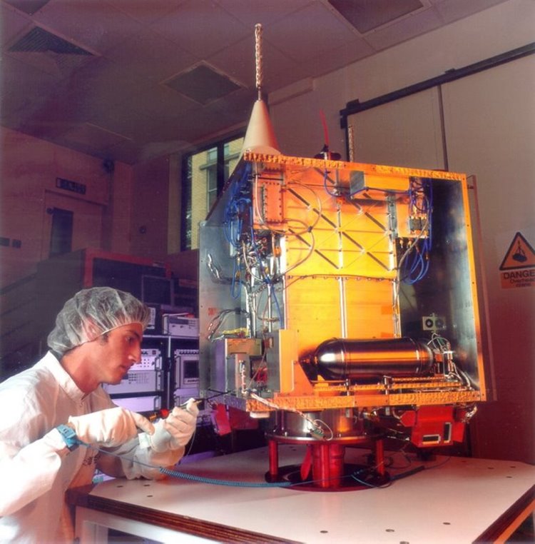
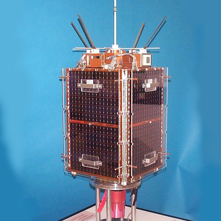
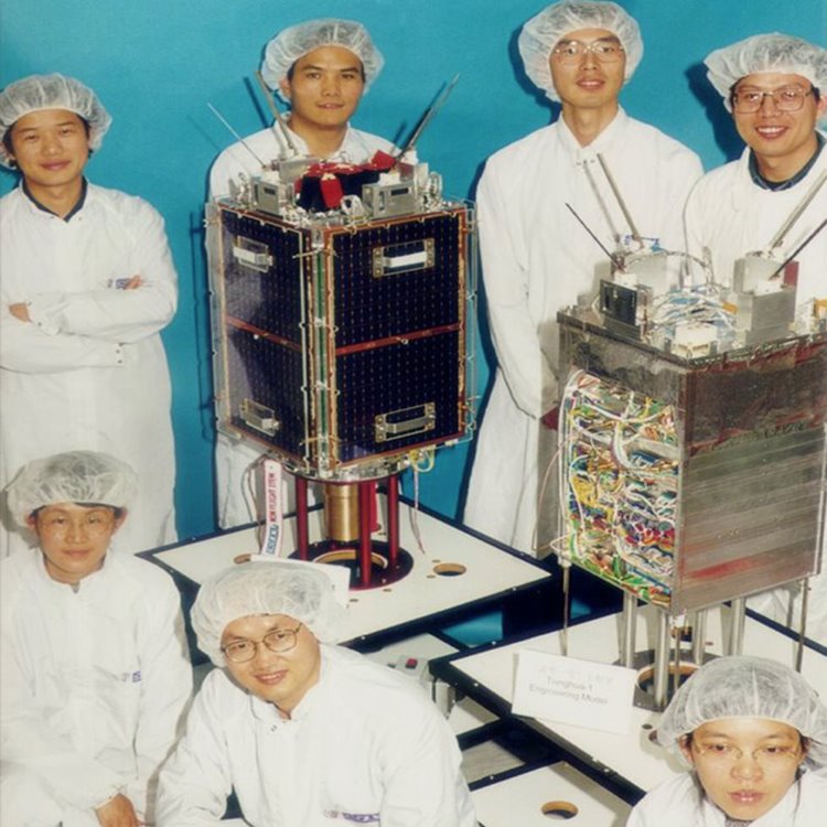
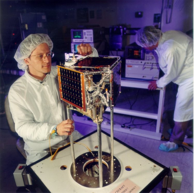
Tsinghua-1 was a microsatellite developed and built in a joint venture between SSTL and Tsinghua University in Beijing, China. A team of 10 Chinese researchers from Tsinghua University worked alongside the SSTL team during the 18 month project.
Tsinghua-1 was a 50kg demonstrator microsatellite with a mission to demonstrate high-resolution imaging for disaster monitoring and mitigation and conduct communications research in LEO.
The SNAP-1 nanosatellite was designed to develop a modular, multi-mission nanosatellite bus (mass range of 10-10kg), to demonstrate the use of miniature electrical and mechanical COTS product technologies in space, and their use as autonomous robots for observing orbiting spacecraft.
SNAP-1 was designed and built as a low-cost research mission by a joint academic-commercial team at the Surrey Space Centre and at SSTL, funded entirely by SSTL.
The TiungSat-1 satellite was Malaysia's first operational satellite and was launched in 2000. The contract with SSTL included training a team of Malaysian space engineers.
TiungSat-1 mission objectives:
· Collection of imagery for environmental and meteorological use
· Digital S&F (Store & Forward) communications
· Technology demonstration
· Space science
· Amateur radio access
UoSAT-12 was an experimental mission used to demonstrate and test a number of new technologies, including imaging cameras, and a high-speed 1 Mbit/s S-band downlink (the MERLION experiment). An Internet Protocol stack was uploaded to the satellite, allowing experiments in extending the Internet to space to be made by NASA Goddard as part of its Operating Missions as Nodes on the Internet (OMNI) effort.
In January 2000, UoSat-12 imaged a lunar eclipse. It also achieved a number of "Firsts" in space - click Discover More.
The satellite platform for the Clementine mission was designed and built by SSTL, and delivered to the prime contractor Thales Alenia for payload integration. The Clementine satellite was part of an intelligence gathering programme for DGA (France) and its mission was to target low frequency electronic signals from targeted regions in the 20 MHz-1 GHz range.
Thai-Paht was the first Thai microsatellite and was launched in 1998 for Mahanikorn University in Bangkok. A team of 12 engineers from the University completed atechnology transfer programme in the UK with SSTL.
FASat-Bravo was the second Chilean experimental microsatellite in orbit, built under a technology transfer program between the Chilean Air Fore and SSTL. The FASat program included the training of Chilenian engineers at SSTL.
FASat-B was a replacement for FASat-A which failed to separate correctly from the primary payload.
FASat-Alpha was the first Chilean experimental microsatellite in orbit, built under a technology transfer program between the Chilean Air Fore and SSTL. The FASat program included the training of Chilenian engineers at SSTL.
FASat-A was launched on August 31, 1995 as a secondary payload to the Ukrainian SICH-1 satellite on a Russian Cyclone-3 vehicle. Unfortunately, the separation mechanism to release FASat-Alpha from SICH-1 failed to operate and some time after the launch, FACh and SSTL declared the spacecraft as lost. The primary payload, SICH-1, was able to perform its observation functions unharmed with the FASat-A permanently attached to it.
Cerise was a French military reconnaissance satellite. Its main purpose was to intercept HF radio signals for French intelligence services.
It was hit by a catalogued space debris object from an Ariane rocket in 1996, making it the first verified case of a collision between two objects in space. The collision tore off a 4.2-metre (13-foot) portion of Cerise's gravity-gradient stabilisation boom, which left the satellite severely damaged, and its performance was compromised.
Healthsat-2 was a commercial digital Store and Forward satellite for medical communications using low cost, portable ground stations.
It was launched on the 25th September 1993, and joined HealthSat-1 (UoSAT-3) as the second SSTL microsatellite in the HealthNet global communications system of SatelLife, a U.S. non-profit organization. HealthNet provided desperately needed low cost 'last mile' communication links between medical institutions and health programmes in the developing world.
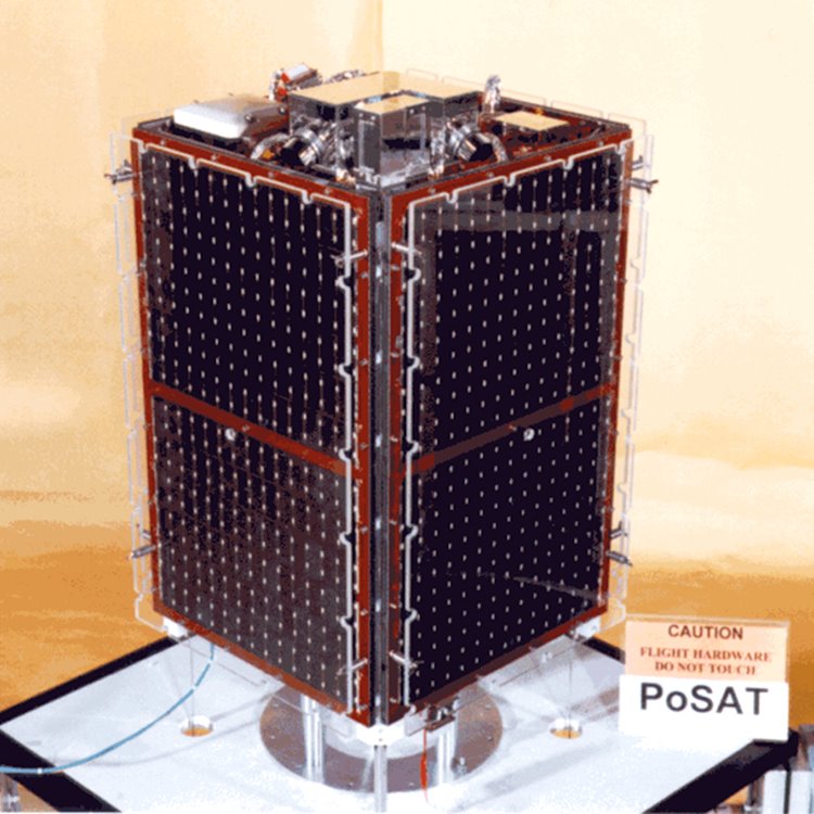
PoSAT-1, the first Portuguese satellite, was launched into orbit on September 26, 1993, from the Kourou Space Centre, French Guiana.
PoSAT-1 was an earth observation and technology demonstration mission. It carried two imagers, one with a wide field of view with 2 km ground resolution, the second narrow field imager provided 200m ground resolution. It also carried a Cosmic Ray Experiment and a Digital Signal Processing Experiment.
Launched in 1992, KITSAT-1 was developed through a collaborative program between KAIST and the University of Surrey. The main objective of the KITSAT-1 program was to acquire satellite technology through the training and education of satellite engineers.
The success of the KITSAT-1 program marked the beginning of space technology development for South Korea, who now have their own commercial satellite manufacturer, SaTReC.
UoSAT-5 was launched on the second ARIANE (40) ASAP on mission V44 on the 17th July 1991 alongside three other secondary payloads ORBCOMM-X, SARA and TUBSAT-1, and main payload the European Space Agency's ERS-1.
UoSAT-5 carried a digital Store and Forward communications and Earth Imaging payload, which were enhanced versions of the UoSAT-4 payloads. The spacecraft operated in the amateur satellite communications service providing a research test bed for new and efficient LEO protocols.
The S80/Tmission was sponsored by CNES and carried an experimental VHF transponder manufactured by Dassault and weighing 7kg, for characterising the radio environment in the 148 to 149.9MHz band in preparation for the proposed S80 constellation mobile communications and positioning system.
UoSAT-3 was the first of the SSTL modular microsatellites and it carried a commercial Store and Forward communications payload with 13MByte of solid state storage and VHF and UHF 9600 bps CPFSK links. For the first 18 months it supported amateur service, but when this was taken over by UoSAT-5, it supported VITA, and later SatelLife as HealthSat-1, and Data Trax Inc. (USA).
UoSAT-2 was the second satellite from the University of Surrey and carried the first operational digital Store and Forward communications payload, a telemetry downlink at 148.825MHz 1200bps, a prototype CCD camera, and an S-band beacon operating at 2401.5MHz.
UoSAT-2 played an important role in the Soviet-Canadian 1988 Polar Bridge Expedition (also known as SkiTrek) which began on March 3, 1988 when a group of thirteen Russian and Canadian skiers set out from Siberia in an attempt to ski to Canada over the North Pole. The nine Russians and four Canadians reached the Pole at the 25th of April where they were welcomed by a group of dignitaries from the Soviet-Union and Canada, members of the international press and radio amateurs involved in support and communications.
The daily progress of the skiers was followed by many thousands of school children and radio amateurs all around the world, who listened to the voice synthesizer on board the UoSAT-2, which transmitted the latest known position of the expedition in FM on the two meter VHF Amateur Radio band, using digitised voice, and through progress reports, produced regularly by AMSAT-NA which were distributed world-wide through Amateur Packet Radio and orbiting amateur satellites.
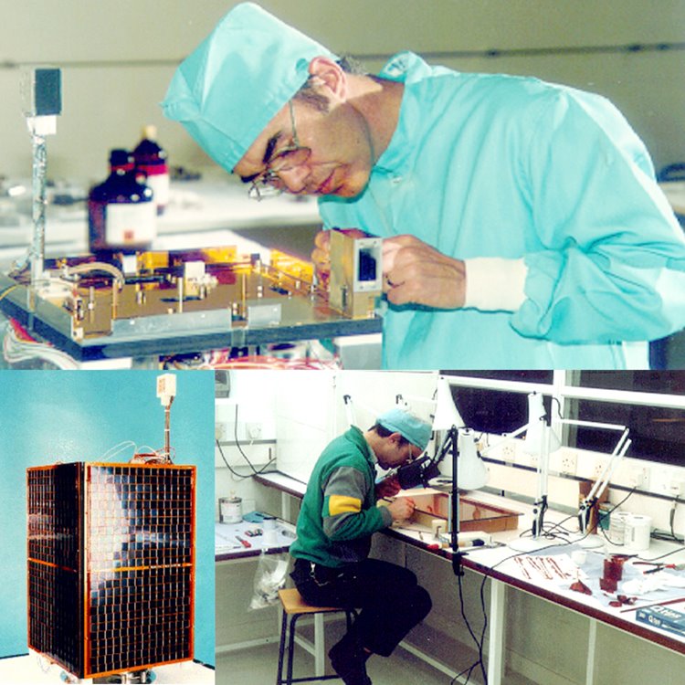
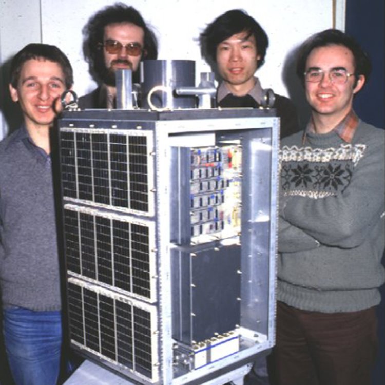
UoSAT-1 was the first satellite designed and built by Martin Sweeting and a small team of research scientists at the University of Surrey. They set out to investigate and demonstrate the feasibility of the design, construction and launch of a scientific small satellite at low cost. The satellite program was completed within a 30 month time-scale, and within a budget of £250,000.
UoSAT-1 signals were heard, decoded and analysed by thousands of radio amateurs, schools, colleges, and universities around the world.
)